Friday 11 September 2015

Day 7: Cranbrook BC - McCall ID

Edit:  There are now photos available from Day 7 but I had to wait until arriving in Battle Mountain to upload them, because The Mgt here know that if they do not provide an adequate service for an establishment full of bloggers, photographers, techies, nerds, spods, ect. ect. they will be killed utterly to DETH.  Though why the Flickr upload last night kept crapping out only for me to discover all the photos had actually uploaded after all is a total wossname.

Something of a contrast in the climate between most of the last Several of days and today.  For starters there was wall-to-wall sunshine.  All.  Day.  Admittedly it was down to four degrees in the shady bits of the Moyie valley this morning, but on the other hand it was thirty-seven in the not-shady bits of the Salmon River gorge this afternoon. And the Man with a Gun at the USAnian border was a jolly fellow too, especially considering the date.  He fell about laughing when I said I'd been to Hyder.  "That's not Alaska" he said between guffaws.  "They even use Canadian money!"  I allowed as how it would do until an opportunity to visit Alaska Proper came along and he wished me a good day.  Hurrah!

Unsurprisingly the northern end of the Idaho Panhandle is almost indistinguishable from the southern end of British Columbia, which is hardly surprising given that from Vancouver to the Great Lakes the border is just an arbitrary line on the map.  Which give rise to sillinesses like Point Roberts.  Unfortunately Flickr is being arsey at the moment and I aten't been able to upload any photos yet.
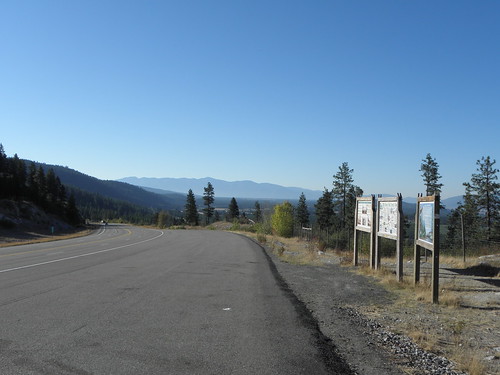
Fig 3: Canada
Fig 4: USAnia
South of Coeur d'Alene the forests more or less disappear, replaced with grassland for the most part.  All the brown looks alien after a week of nowt but trees (and rain).  When you reach the edge of the valley in which Lewiston1 nestles the view would be quite spectacular if Flickr were not still being arsey and causing the photos to remain firmly on my lapdancer rather than floating around the stratocumulus.  I do not think the network here is much cop.  I took the old road down into Lewiston as Ford have finally listened and fitted paddle shifters to the steering wheel.  Merry tunes are played; I think Sport mode Does Things to the exhaust to make it louder too.
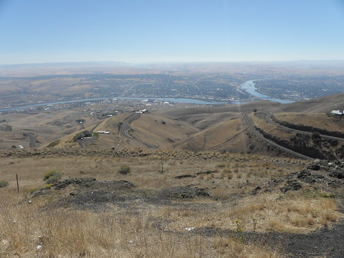
Looking down at Lewiston
US-95 continues its merry way south to Grangeville, where it drops off the edge of the world, or at least the edge of the White Bird Summit.  I came down here in 2009, and back up in 2010 (though on the latter occasion it was so foggy I could barely see the end of the "hood", never mind the scenery).  The old road (White Bird Grade) had about forty hairpins and bits of it are still visible; the new one, dating from 1975, is known as Seven Mile Hill and would be a blast on a bicycle.  I'd show you some pictures if Flickr wasn't being arsey ect. ect.
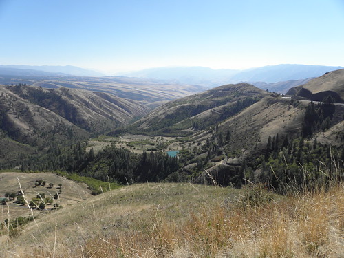
View from White Bird Summit.  Seven Mile Hill at R; bits of old White Bird Grade visible lower down the slope
In the Salmon River gorge the forests take over again and US-95 turns sharp left to bring the weary traveller to McCall.  And he is pretty weary because although he gained an hour from crossing back into the Pacific Time Zone, he promptly lost it again as the edge of the Pacific/Mountain divide goes smack across the middle of this bit of Idaho.  A few years ago I stayed in Ontario ID, where the boundary goes through the town, with the hotel in one zone and dinner in the other.

Eight miles to go and there is a dot-matrix sign at the roadside.  "Road work2.  Single lane traffic. Delays of 20-30 minutes".  They do not mess around in this country.  Happily I was stopped for but a couple of minutes before creeping through the 8/10 of a mile of cones and back onto a Proper Road.  And I need to go that way tomorrow morning no matter whether I go down towards Boise and pick up I-80 east of Elko or divert into Oregon and approach Battle Mountain from the west.  Arse.


McCall is titchy and on the edge of the picturesque Payette Lake, but for once I cannot blame Flickr being arsey for the lack of photos of this, but rather the lateness of the hour and the hungriness of Mr Larrington.  I shall point the camera at the lake tomorrow.

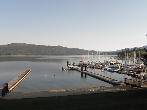
Payette Lake first thing Saturday morning and yes, it was bloody freezing
And I will try again to bung in some photos.  I snapped nine bridges today, so CrinklyLion will be having withdrawal symptoms.  Especially as Bill Plumtree has temporarily abandoned his snapping of the bridges on the Lancaster Canal to go on holibobs.
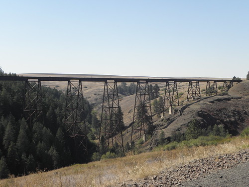
Pick of Friday's bridges, between Lewiston and Grangeville
  1. Unsurprisingly, there is a Clarkston on the other side of the river, but that's in Oregon Washington where We Will Not Go3.
  2. Always singular in USAnia.
  3. Not today, anyway.

No comments:

Post a Comment

O hai, spammers!

All comments are moderated so don't bother.

Kthxbai!